Wednesday, June 16, 2010
Back In St. Catharines
Second Day In Vancouver, British Columbia


Arrival In Vancouver, British Columbia
Population(2): 2 160 000
Population Density(3): 4.6/km2
Landforms(4): Western Cordillera
Climate(5): Pacific Maritime
Ecozone(6): Pacific Maritime
Closest National Park(7): Mount Revelstoke National Park
Industries(8): Forestry, Urbanization, Agriculture, Fish Processing, Tourism, Recreation
Tourism: B.C. Place Stadium, Large Malls, Botanical Gardens, Cirque Du Soleil ,etc.
Below: Map Of Vancouver (9)


(2) Making Connections: Canada’s Geography (Textbook)
(3) Making Connections: Canada’s Geography – Pg. 101-116 (Figure 11.1) [Textbook]
(4) Making Connections: Canada’s Geography – Pg. 127-143 (Figure 12.16) [Textbook]
(5) Making Connections: Canada’s Geography – Pg 157 – 165 (Figure 14.2) [Textbook]
(6)http://atlas.nrcan.gc.ca/site/english/maps/reference/national/natpks_e/referencemap_view
(7) Making Connections: Canada’s Geography – Pg 239-402 [Textbook]
(8) Making Connections: Canada’s Geography [Textbook]
(9) http://www.lonelyplanet.com/maps/north-america/canada/vancouver/
(10) http://www.skyscrapercity.com/showthread.php?p=50712907
(11) http://www.dudli-werdenberg.ch/vancouver/bilder-granvilleisland.htm
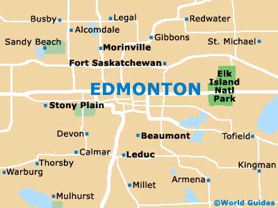
Second Day In Edmonton, Alberta


Monday, June 14, 2010
Arrival In Edmonton, Alberta
Population(2): 1 001 600
Population Density(3): 1067.2/km2
Landforms(4): Interior Plains
Climate(5): Boreal
Ecozone(6): Boreal Plains
Closest National Park(7): Elk Island National Park
Industries(8): Forestry, Farming, Tourism, Oil & Gas development


(1) http://mapsofworld.com/lat_long/canada-lat-long.html
(2) Making Connections: Canada’s Geography [Textbook]
(3) Making Connections: Canada’s Geography – Pg. 101-116 (Figure 11.1) [Textbook]
(4) Making Connections: Canada’s Geography – Pg. 127-143 (Figure 12.16) [Textbook]
(5) Making Connections: Canada’s Geography – Pg 157 – 165 (Figure 14.2) [Textbook]
(6)http://atlas.nrcan.gc.ca/site/english/maps/reference/national/natpks_e/referencemap_view
(7) Making Connections: Canada’s Geography – Pg 239-402 [Textbook]
(8) Making Connections: Canada's Geography
Friday, June 11, 2010
Second Day In Sudbury, Ontario


Thursday, June 10, 2010
Arrival in Sudbury, Ontario
Population(2): 157 857
Population Density(3): 49.3/km2
Landforms(4): Canadian Shield
Climate(5): Boreal
Ecozone(6): Boreal Shield
Closest National Park(7): Pukaskwa National Park
Industries(8): Forestry, Mining, Tourism, Recreation, Trapping
Tourism(9): Many Malls, Art Galleries and things
such as Go-Karting, etc.
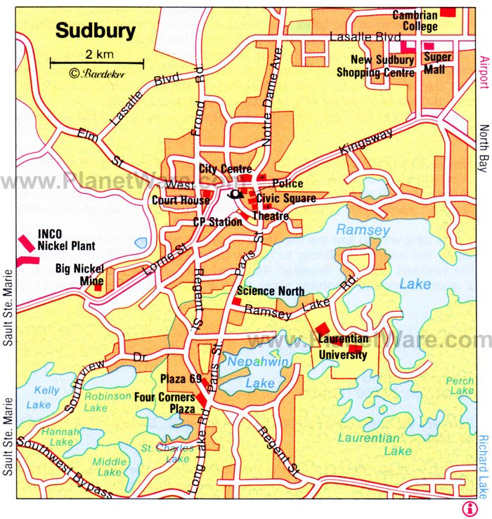
Map Of Sudbury(11):


Above: New Sudbury Centre (9)
Below: La Galerie de Nouvel-Ontario (10)

Links:
(1) http://mapsofworld.com/lat_long/canada-lat-long.html
(2) Making Connections: Canada’s Geography (Textbook)
(3) Making Connections: Canada’s Geography – Pg. 101-116 (Figure 11.1) [Textbook]
(4) Making Connections: Canada’s Geography – Pg. 127-143 (Figure 12.16) [Textbook]
(5) Making Connections: Canada’s Geography – Pg 157 – 165 (Figure 14.2) [Textbook]
(6)http://atlas.nrcan.gc.ca/site/english/maps/reference/national/natpks_e/referencemap_view
(7) Making Connections: Canada’s Geography – Pg 239-402 [Textbook]
(8)
(9) http://www.rainbowcountry.com/members/in/greater-sudbury/new-sudbury-centre
(10) http://gn-o.org/node/1056
(11) http://www.planetware.com/map/sudbury-map-cdn-cdn454.htm
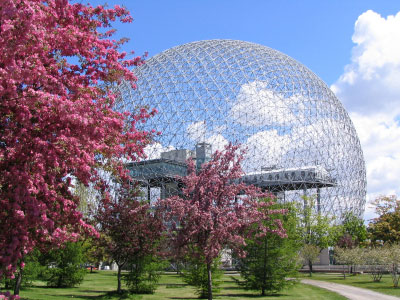
Second Day In Montreal, Quebec


Arrival in Montreal, Quebec
Latitude & Longitude: 47°14'N, 84°39'W
Population: 375 0
00
Population Density: 4439/km2
Landforms: Canadian Shield
Climate: South Eastern
Ecozone: Boreal Shield
Closest National Park: La Mauricie National Park
Industries: Forestry, Mining, Tourism, Recreation, Trapping


(1) http://mapsofworld.com/lat_long/canada-lat-long.html
(2) Making Connections: Canada’s Geography (Textbook)
(3) Making Connections: Canada’s Geography – Pg. 101-116 (Figure 11.1) [Textbook]
(4) Making Connections: Canada’s Geography – Pg. 127-143 (Figure 12.16) [Textbook]
(5) Making Connections: Canada’s Geography – Pg 157 – 165 (Figure 14.2) [Textbook]
(6)http://atlas.nrcan.gc.ca/site/english/maps/reference/national/natpks_e/referencemap_view
(7) Making Connections: Canada’s Geography – Pg 239-402 [Textbook]
(8) Making Connections: Canada's Geography
Monday, June 7, 2010
My Second Day In Halifax


Tuesday, June 1, 2010
Arrival In Halifax, Nova Scotia
Latitude & Longitude(1): 44°38'N, 63°35'W
Population(2): 375 000
Population Density(3): 67.9/km2
Landforms(4): Appalachians
Climate(5): Atlantic Maritime
Ecozone(6): Atlantic Maritime
Closest National Park(7): Kejimkujik National Park
Industries(8): Forestry, Agriculture, Fishing, Tourism, Urbanization
Tourism: Churches, Art Galleries, Parks, War Museums, Aviation Museums, etc.
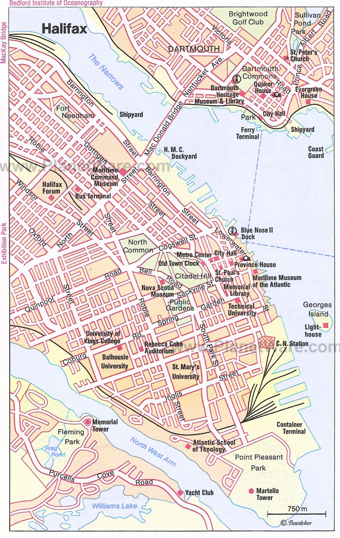
Below: A map of Halifax (9)


(1) http://mapsofworld.com/lat_long/canada-lat-long.html
(2) Making Connections: Canada’s Geography (Textbook)
(3) Making Connections: Canada’s Geography – Pg. 101-116 (Figure 11.1) [Textbook]
(4) Making Connections: Canada’s Geography – Pg. 127-143 (Figure 12.16) [Textbook]
(5) Making Connections: Canada’s Geography – Pg 157 – 165 (Figure 14.2) [Textbook]
(6)http://atlas.nrcan.gc.ca/site/english/maps/reference/national/natpks_e/referencemap_view
(7) Making Connections: Canada’s Geography – Pg 239-402 [Textbook]
(8) Making Connections: Canada's Geography [Textbook]
My Vacation
- Halifax, Nova Scotia
- Montreal, Quebec
- Sudbury, Ontario
- Edmonton, Alberta
- Vancouver, British Columbia

