Population(2): 157 857
Population Density(3): 49.3/km2
Landforms(4): Canadian Shield
Climate(5): Boreal
Ecozone(6): Boreal Shield
Closest National Park(7): Pukaskwa National Park
Industries(8): Forestry, Mining, Tourism, Recreation, Trapping
Tourism(9): Many Malls, Art Galleries and things
such as Go-Karting, etc.
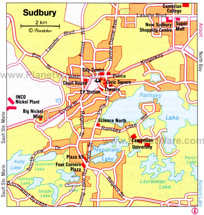
Map Of Sudbury(11):


Above: New Sudbury Centre (9)
Below: La Galerie de Nouvel-Ontario (10)

Links:
(1) http://mapsofworld.com/lat_long/canada-lat-long.html
(2) Making Connections: Canada’s Geography (Textbook)
(3) Making Connections: Canada’s Geography – Pg. 101-116 (Figure 11.1) [Textbook]
(4) Making Connections: Canada’s Geography – Pg. 127-143 (Figure 12.16) [Textbook]
(5) Making Connections: Canada’s Geography – Pg 157 – 165 (Figure 14.2) [Textbook]
(6)http://atlas.nrcan.gc.ca/site/english/maps/reference/national/natpks_e/referencemap_view
(7) Making Connections: Canada’s Geography – Pg 239-402 [Textbook]
(8)
(9) http://www.rainbowcountry.com/members/in/greater-sudbury/new-sudbury-centre
(10) http://gn-o.org/node/1056
(11) http://www.planetware.com/map/sudbury-map-cdn-cdn454.htm


No comments:
Post a Comment